WHIDBEY AIRPARK
  • Home
  • Weather
  • Fees and Donations
  • Visit
  • Blog
  • Contact
  • Home
  • Weather
  • Fees and Donations
  • Visit
  • Blog
  • Contact

December 2019

12/31/2019

0 Comments

 
Cheers to 2020 and wishing all of our friends and family of W10, peace, joy and happiness all year long.

Saturday Social
As always we are continuing our monthly Saturday Social at 10 am on the first Saturday of each month at The Muk.  Join us this Saturday, January 4th for some coffee and breakfast with fellow aviation enthusiasts.  

2019 in Review
Before looking forward to 2020 we just wanted to reflect on what happened in 2019 here at W10 (in no particular order):
  1. Successfully completed the first W10 ground school thanks to Dave Bennett, AGI.
  2. South Whidbey Flying Club has successfully trained more private pilots with a whole group of folks having passed their written exam and just waiting to take their oral and practical test to finalize the process thanks to Fred Lundahl, CFI
  3. Started Taxiway Talks as well as Tuesday Talks (name may change in the near future) for further aviation insight, understanding and discussion.
  4. Successfully had our first Young Eagles Event.
  5. Started offering underwing (under-rotor) camping.  East side sight had fire pit installed and ground leveled.
  6. Information Kiosk for airport in formation and the WSDOT passport stamp was completed and put in use.
  7. On field classroom/meeting room set up and available.
  8. New (used) lawn mower acquired and looking forward to spring mowing.
  9. Permit for clearing and grading submitted to the county to continue to work towards new hangars, helipads, south end trough clean out and future office building projects.
  10. Acquired a fire truck for the field.  
  11. Courtesy car acquired and put into use.

Looking forward into 2020 - W10's projects:
  1. Start clearing and grading areas for new hangars, helipads, south end approach and future office building projects.
  2. Get plans and permit submitted to the county for the new hangars.
  3. Get new fence up on the North end of the field.
  4. Get sign on Crawford road to indicate airport access(?)
  5. Start up another Ground School session.
  6. Continue with the Taxiway talks and Tuesday Talks.
  7. Hold another Young Eagles event and increase pilot participation.
  8. Hold some pancake breakfasts.
  9. Continue some garden parties when the weather is cooperating.
  10. Get the runway cracks filled again when the weather is better.
  11. Continue to outfit the fire truck with first aid and emergency response equipment.

Private Pilot Ground School
Dates for the next ground school are being planned out.  If you have any questions about ground school please contact Dave Bennett at [email protected] or Tara or Sky Rudolph at W10 via email at [email protected] or call us at 360-321-0510. 
 
Tuesday Talks (Name to change so other days are not excluded)
Need a refresher or still never quite understood aspects of things a pilot should know?  Dave has graciously agreed to hold classroom sessions to go over subjects like airspace, weather, navigation and flight planning, airplane systems, aerodynamics, radio procedures, weight and balance, safety, predicting performance, etc.  
It's still a bit too soon after the holidays to finalize dates but as soon as we make them then we'll email you as these plans come together.

Taxiway Talks
Our third and fourth Taxiway Talks are in the makings so stay tuned and we'll let you know the topic and dates/times as soon as they are finalized.

Instructor's Corner
This month's contribution about choosing the right altitude comes from Dave Bennett, AGI.  If you still have any questions, let Dave ([email protected]) know.
 
From Dave's desk:
What’s the right height?
Altitude is a pretty simple concept.  We monitor our height above Mean Sea Level (MSL) with our altimeter to maintain separation between our airplane and solid objects fixed to the earth.  Provided we have set the Kollsman window to the correct pressure, we have a pretty good idea of our vertical position in the world.
Now along comes GPS.  In addition to our altimeter (required equipment) we often have the GPS capability (not required equipment) in the cockpit, displaying another source of altitude on our iPad, phone or whatever.  The two sources of altitude will no doubt differ, casting doubt on which is correct.  Another dilemma.
On a clear, cold beautiful PNW day at 10,500 ft over the Cascades and the outside air temperature (OAT) was a brisk -12 oC, I noticed my Foreflight GPS altitude was about 500ft lower than the indicated altitude.  I knew the altimeter is subject to errors on non-standard temperature days, but got to “overthinking” the difference which leads to the question of the day.  Which altitude should we fly during cruise on a VFR flight ?
I’ll give you some choices:
  1. GPS altitude.  It’s always correct and a pretty close representation of the true altitude.   
  2. Pressure altitude, as that is what our transponder provides to ATC.
  3. Absolute altitude, as that is the height above the terrain.
  4. Indicated altitude, a consistent representation of MSL for localized current conditions.
The Pilots Handbook of Aeronautical Knowledge (PHAK – FAA-H-8083 -25B, free download from the FAA) chapter 8 discusses 5 types of altitude:  
  • Indicated altitude—read directly from the altimeter
    when it is set to the current altimeter setting (uncorrected for temperature).
  • True altitude—the vertical distance of the aircraft above sea level—the actual altitude. It is often expressed as feet above mean sea level (MSL). Airport, terrain, and obstacle elevations on aeronautical charts
    are true altitudes.
  • Absolute altitude—the vertical distance of an aircraft above the terrain, or above ground level (AGL).
  • Pressure altitude—the altitude indicated when the altimeter setting window (barometric scale) is adjusted to 29.92 inches of Hg. This is the altitude above the standard datum plane, which is a theoretical
    plane where air pressure (corrected to 15 °C) equals 29.92 inches of Hg. Pressure altitude is used to compute density altitude, true altitude, true airspeed (TAS), and other performance data.
  • Density altitude—pressure altitude corrected for variations from standard temperature. When conditions are standard, pressure altitude and density
    altitude are the same. If the temperature is above standard, the density altitude is higher than pressure altitude. If the temperature is below standard, the density altitude is lower than pressure altitude. This is an important altitude because it is directly related to the aircraft’s performance.
The above definitions help, but do not define what altitude a VFR pilot should be flying.  The answer is found in FAR 91.121:
Sec. 91.121 — Altimeter settings.
(a) Each person operating an aircraft shall maintain the cruising altitude or flight level of that aircraft, as the case may be, by reference to an altimeter that is set, when operating--
(1) Below 18,000 feet MSL, to--
(i) The current reported altimeter setting of a station along the route and within 100 nautical miles of the aircraft;
(ii) If there is no station within the area prescribed in paragraph (a)(1)(i) of this section, the current reported altimeter setting of an appropriate available station; or
(iii) In the case of an aircraft not equipped with a radio, the elevation of the departure airport or an appropriate altimeter setting available before departure;
Pilots are required to fly the airplane per the indicated altitude.  

FAR 91.121 does not reference any corrections for non-standard temperature, so no corrections for temperature should be applied.  If you are flying IFR, corrections for temperature are more important and some approaches require temperature compensation under certain extremes. 
It is important to fly at the indicated altitude per your flight plan or when ATC has instructed you to fly a specific altitude.  It is also important when you tell ATC what altitude you are flying that it be the indicated altitude.  ATC expects you to fly the indicated altitude, not corrected for temperature. 
This seems a little odd, because indicated altitude is not output on your transponder.  Your transponder outputs pressure altitude (altitude set against a standard 29.92 in of Hg).  What the controller will see is your transponder output pressure altitude corrected (by their system) for the appropriate altimeter, providing the guy on the radio with the same indicated altitude you see. This assures everyone in the same area will be flying based on a consistent indicated altitude.  If there are temperature errors, they should in theory apply to all airplanes in a specific area. 
Above 18,000 ft, all airplanes use flight level (FL) which is based strictly on pressure altitude. 
Answers:
  1. Is incorrect because GPS altitude compensates for temperature.  Other aircraft will not be correcting for temperature, so not everyone will be flying at their expected altitudes and aircraft separation can be compromised.
  2. Is not correct as pressure altitude is used above 18,000 ft MSL and referred to as Fight Level.
  3. Is incorrect as unless an airplane is equipped with a radar altimeter (RA), there is no way for unequipped airplanes to determine absolute altitude.
  4. Is correct as this is what is required by FAR 91.121 and it does not mention compensating for temperature. 
If you want to know more about temperature errors in your altimeter, check out the PHAK chapter 8.  It has some really good descriptions and tables that allow you to determine the appropriate altimeter corrections for non-standard temperatures.

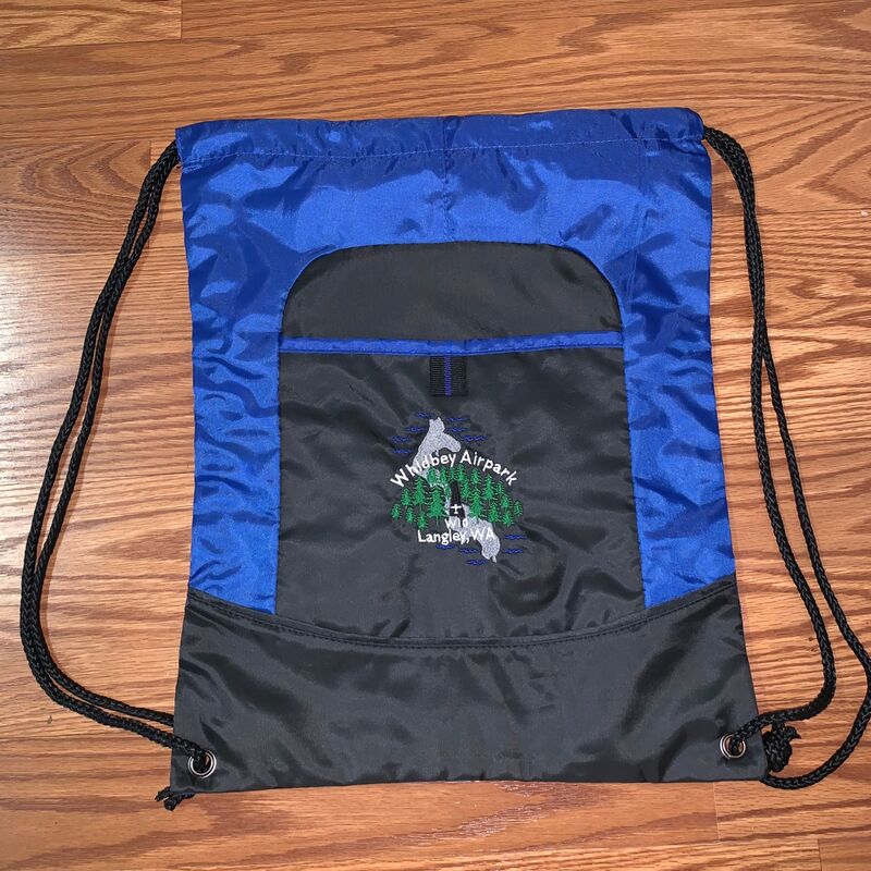
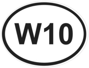
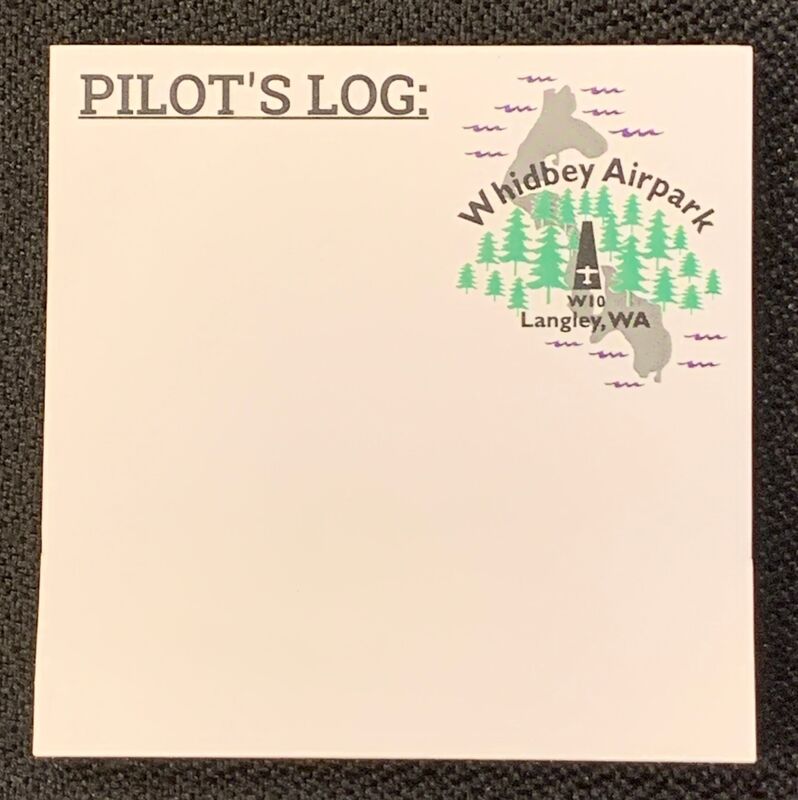
W10 Swag
Currently there are Cinch Bags ($15) and W10 oval vinyl stickers ($5) and now NEW 50 sheet post-it notes ($3) available so you can represent your favorite little airport in the woods.  All proceeds go towards the airport to help with maintenance and improvement projects.  
Picture
Picture
Picture
Stay warm and safe out there-
Blue Skies!
Sky and Tara Rudolph
e-mail: [email protected]
0 Comments


Leave a Reply.

    Newsletter Sign-up

    Please visit our contact page to sign up for our newsletter!

    Archives

    November 2023
    July 2023
    July 2022
    April 2020
    March 2020
    February 2020
    January 2020
    December 2019
    November 2019
    October 2019
    September 2019
    August 2019
    July 2019
    June 2019
    May 2019
    April 2019
    March 2019
    February 2019
    January 2019
    December 2018
    October 2018
    September 2018
    August 2018
    July 2018
    May 2018
    April 2018
    March 2018
    January 2018
    August 2017
    June 2017
    March 2017
    February 2017
    January 2017

    Categories

    All

    RSS Feed

Site powered by Weebly. Managed by Hostmonster